Showing posts with label Backpacking. Show all posts

Monday, May 4, 2009

PCT Section A (northbound)

As some of the passes in Section B were still covered in ice and snow, I decided to hike Section A again this year. This time I hiked northbound, so I could spend some time getting to know a few of this year's thru-hikers.

I drove down to Lake Morena, after picking up Freebie, Tomato, and Raw in Portland. After a bit of car trouble on the I-5, we arrived late in the evening on the 23rd and cowboy camped under a tree to avoid the worst of the damp. The next morning, we got a ride down to the border near Campo with Greg "Strider" Hummel, who hiked the PCT in 1978. He told us some entertaining stories about how the trail had changed in the last 2 decades, then sent us on our way after a quick photo shoot at the monument.

Glad to be on the trail after such a long drive, I was fully enjoying every mile of the trail. Rolling, dusty hills with dry scrub and abandoned paraphernalia from the illegal immigrants provide the backdrop while the trail twists around and crosses the local dirt roads of Campo. After a few hours, the trail descends into Hauser Canyon, and at the bottom is a nice shady spot for lunch. Here we met I-Spy, Bootie (still Sarah at this point), and Pockets. I-Spy explained how he had just recently obtained his trail name, after using his monocular to track some illegals.

The hike up the north side of Hauser Canyon is not too steep, but is fairly long and I was fairly low on energy by the end. A few high energy snacks and the last of my water got me through the last stretch before camp, to complete a fun and picturesque 20 miles.

Back at the kick-off party (ADZPCTKO) I settled into a beer or two, and spent the evening chatting with old friends from last year (The Onion, Nitro, Heinz, Duckie, Nano, to name a few) and meeting too many new friends to name. Some people had already been hiking for a week, so we got updates on blisters, water, snow, and the usual trail gossip. Saturday was spent relaxing, eating, and checking out the vendors. Later that evening we got to see the latest installation from Squatch's quadrology, "Walked", as well as the 5-years-in-the-making, yet-to-be-completed first half of "Tell it on the Mountain."

Sunday morning we awoke to frost on the tent (or sleeping bag, in Tomato's case), then packed up ready for the trail. Duckie kindly offered to drive some of our gear to Mt. Laguna, so I gave him my extra food and only had to carry about 11 pounds for the 23 mile section. I opted to keep all of my gear with me in case of any trouble making it there, so technically it wasn't a true "slack-pack" but it certainly was nice. The weather was once again just right for hiking, clearskies but not too hot, and the hiking was brilliant. A few miles before the Mt. Laguna store, we realized it was going to be very tight to make it there before it closed at 5:00. Tomato was having one of his usual ice cream cravings, so he picked up the pace and left us behind. I continued along steadily, and at 4:51 I reached the road junction where it was a half mile walk to the store. I didn't really want anything, but figured an ice cream would be nice, so I switched into a fast walk. A hiker without a pack jogged by me and threw a taunt my way, so for some reason I went into a full sprint and raced him to the store. He beat me, but I still got there with one minute to spare. I had my ice cream while I caught my breath, and spent the next hour loitering on the Mt. Laguna steps as so many hikers have done before me.

As a treat to our thru-hiking friends, Duckie and I rented a cabin to share with Tomato and Freebie. The evening was nice, but we couldn't quite relax as we didn't know where Raw was. Raw had opted to do a complete slack-pack, so Duckie had all of his gear. It was slowly getting darker, colder, and windier. By 7:00 we took a drive around the area to try to find a sign of him, but had no luck. We left messages with campers nearby, and a note on the store message board, but at this point we were actually getting quite worried. Luckily, around 8:00, a truck showed up at our cabin and dropped a very exhausted Raw off. It turns out he had arrived in the area an hour before, but we hadn't been clear on where we were meeting. He eventually got the message from the campers that we were in a cabin, and found us. Now able to relax, we had some pints and helped Raw lighten up his pack a bit.

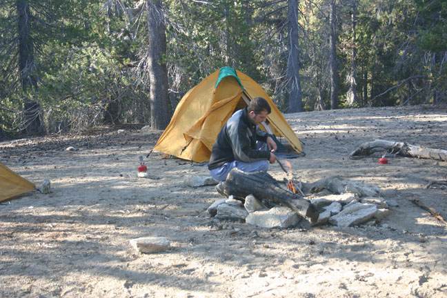
On Monday we hiked another clear, comfortable temperature day to just North of the Sunrise Trail Head. It was incredibly windy at this point, and finding a sheltered camp site was proving difficult. After getting water at the Sunrise Trail Head, we hiked a few miles further and then found a somewhat-sheltered gully. The wind battered the tent around all night, and I had trouble sleeping until I finally realized I had earplugs with me. This granted me a few hours of uninterrupted sleep, and I woke up refreshed and ready for more miles.

On Tuesday morning the wind had calmed down a little bit, but it was still a bit cool. Tomato, who didn't have the comfort of a tent, made a quick getaway. Freebie and I followed shortly after, and we all met up for lunch. Later on in the day we ran into Buddy Jesus at the Pioneer Mail campground, and he advised us to drink water. His actual words were, "If I can give you one piece of advise on the PCT, it's DRINK WATER." With this morsel to chew on, hilarity ensued for many more miles. We arrived at our destination for the day, Scissors Crossing, in mid afternoon. Not ready to settle down yet, Tomato and I caught a ride into Julian where we enjoyed milkshakes and hung out in the library to catch up on email. The proprieter of the local outfitter gave us a ride back to the trail at 5:30, where we met up with Freebie, I-Spy, Bootie, and pockets. Another windy tent set-up, then pass-the-pigs until we couldn't see any more.

Wednesday was going to be my longest day at 24 miles. It was also the crossing of the San Felipe hills, which, although not steep, is a long and dry stretch. The morning was cool, and we got an early start, so we made the Third Gate water cache for an early lunch siesta. A number of other hikers were here, including Buddy Jesus dropping down some more useful knowledge. We stayed for all we could take, then hiked the rest of the way to Barrel Springs where we were soothed to sleep by the resident frogs.

The last day of my hike was a short 10 miles to Warner Springs. The scenery is drastically different in this brief section, featuring oak forests, rolling meadows (replete with cows), and, arguably the most photographed spot on the trail, Eagle Rock. Tomato and I were both very low on food, so the draw of breakfast at the Warner Springs Country Club was very strong. Freebie proved to be a misnomer as he shared the last of his energy bars with us as we caught some extra photos at Eagle Rock, then we moseyed northwards.

Warner Springs Ranch deserves its own paragraph. A clean, well provisioned resort, they drop all pretense of standards and actually welcome hikers to soil their establishment. Deep discounts and friendly staff get you in the door, and 105 degree hot springs keep you there. We made full use of the amenities, spending countless hours floating around in the hot and slightly-less-hot pools. Although the hiking was incredible, Warner Springs was the icing on the cake for this trip.

Thursday night our gang crammed into my car and we went up to a Mexican Restaurant in the metropolis that is Sunrise Summit. Good food, good drink, and a well aged Christmas Tree mixed with new and old friends made for a fun evening. Another dip in the springs that night, and I started to feel the sadness as I knew all my friends would be resuming their hike northbound in the morning, and all I had to look forward to was a 1000 mile drive. Friday morning we took our time getting up, and had a leisurely breakfast at the golf club. I drove a few folks the 8 miles to the nearest grocery store for a resupply (the Warner Springs gas station isn't bad in a pinch) and then said my goodbyes. I was very jealous, and sad to part with everyone, but was also missing home.

The drive home was pretty uneventful. I drove to just south of Redding on the Friday evening, then got up early and drove the next 800 miles to make it to the ferry by 7:00pm. I just caught the 7, and was home by a little after 9:00 to an empty house. My fiancee went out for the evening as she wasn't expecting me to be home until after 11, whoops!

(Note: I had originally started to blog this hike from my Blackberry on the trail, but really didn't enjoy the experience. I've deleted those posts as they were rather incoherent.)

Monday, September 8, 2008

West Coast Trail

It started innocently enough. A group of us were sitting around a picnic table at the ADZPCTKO in Lake Morena, sharing hiking stories. I started describing my 2006 hike on the West Coast Trail, and the scenery and ruggedness got the attention of a few. Fortified by beer, 3 or 4 of my new friends expressed interest in a late summer WCT trek.

4 months later, there I was making a trip to the ferry to pick up Brian (Tomato) and Leila (Swifty). My fiancee, Rebecca, kindly offered to drive us all to the Bamfield trail head on Monday, Sept 1. We had a campsite reserved at the beautiful Pachena Bay Campground right by the trail head. After a dinner of campfire-roasted hot dogs and a quiet night by the beach, we said goodbye to Rebecca and Shadow and proceeded to the Parks Canada office for our orientation.

All hikers on the WCT are required to take the 1.5 hour orientation, which is offered 4 times daily. We diligently watched the PowerPoint presentation, grabbed our permits, and hit the trail at 10:45. When starting at the North end of the trail, the terrain is quite easy and the miles go by quickly. Our first stop on the way to Tsocowis (km17) was at the Pachena Lighthouse. The Lighthouse grounds are open for exploration, and panoramic views give a preview of the scenery to come. The guest book entries at the Lighthouse provided much hilarity, and started some running gags that lasted the duration of our trip. You really had to be there to appreciate them.

After a bit more inland hiking, we reach Michigan Creek and the beginning of beach walking. A sealion haulout rock provides ample entertainment for a lunch stop, and we're blown away by the size of these massive creatures. Swifty presented us with a list of wildlife she expects to see on the trail, and the first one is crossed off. Moving on, we explore the shipwrecks of the Michigan and Uzbekistan, as well as some nice rock shelves and tidal pools. The low tide enabled shelf-walking, often referred to as a hiker superhighway. Because we were making such good time, we walked right by our destination and didn't realize our mistake until we reached the impassible Valencia Bluffs. After my cohorts teased their "experienced" route planner, we realized the fortune of our mistake and explored some beautiful waterfalls and rock formations. A short backtrack took us back to Tsocowis and a soft, sandy campsite. The evening presented a stunning sunset and plenty of wood for a fire.

The next morning began with some forest walking, which on the WCT inevitably means mud. Lots of mud. Fortunately, there had been no rain for a couple of days, so the mud wasn't as bad as it can be. The three of us had very light packs, trail runners, and hiking poles, so we were able to hop over and navigate our way through the mud with little effort. Heavily-laden hikers coming the other way took a look at our relatively clean feet and assured us that the mud got much worse. We were offered advice such as "You haven't seen anything yet" and "Hope you brought your gators.. or a life jacket!". While well-meaning, their comments became more fodder for our trail banter, and the theme of inflatable flotation-device gators began.

Tomato and Swifty have extensive hiking resumes, both having done successful Pacific Crest Trail thru-hikes, among many other accomplishments. I had warned them that it was a different breed of hiker on the WCT, but I don't think I could have prepared them for the absurdity we witnessed. 80 lb. packs were commonplace, and we even saw several people with a pack on their front as well as the back. Although we all started heavy in our earlier hiking days, it was unbelievable that people would attempt a trail as rugged as the WCT without any research at all. "At least they're out there" we agreed, and kept our observations to ourselves.

I digress - back to the trail. At Trestle Creek we're rewarded with more beach walking, taking us to our first cable car crossing at Klanawa River. A group of fellows heading South demonstrated how to help each other across, and waited around to give us a hand. Having people on the cable car landing to pull the car across makes it much easier than pulling yourself when you're in the car. The pulleys were also in much better shape than my 2006 trip, so the crossing was fast and fun. A few more inland miles, along with some impressive ladders, took us to Tsusiat Falls for lunch. The tides and storms change this beach annually, and what in 2006 was a large freshwater pool at the base of the falls was now a tidal bay with steep banks. Swifty and I braved the cold water for a quick shower under the falls, while Tomato settled for the mist bath available nearby. The waterfall is astounding to watch, but the strutting alpha-males offered scenery we didn't come to see, so we packed up and headed back up the ladders to the trail.

Moving on through more inland mud, our next stop is to wait for the ferry at Nitnat Narrows. We chat with some fellow hikers here for half an hour until the ferry comes for the short trip across the narrows. On the South side we're offered beer and seafood, but decide to keep trekking. There is quite a crowd there, and we agree we'd rather be hiking. Right after the ferry dock is a swampy area, flooded several years ago by a beaver dam. The boardwalk is in rough shape, but we motor on through to the beach access at Cheewhat River. Some fun beachcombing with a few inland detours around surge channels brings us to Cribs Creek, our campsite for night two.

Cribs Creek is a large, picturesque beach and a popular camping spot. There's probably 40 people already camping there when we arrive, so we cross to the south side of the river which is currently unoccupied. After finding a small spot between the logs in which to cram our three tarptents, we count another 20-30 hikers come from both directions. Every available spot near us is occupied, but once the sun goes down a bit it doesn't feel so crowded. For some reason nobody decides to camp on the gently sloping beach at the far North end, where I camped in '06. Wood is scarce, but we scrounge up enough for a comfortable fire and enjoy an evening of stargazing and conversation. I suggested it would have been nice to have grabbed a few beers from the Nitnat ferry dock, but, alas, hindsight is 20/20.

Day three brings us an overcast morning, but a feature-filled day of hiking is ahead of us. After a beautiful beach walk to Carmanah Point, we head up the steps to explore Carmanah Lighthouse. A few photos and sights keep our interest, but the thought of breakfast at Chez Moniques keeps the visit brief. Soon we're heading down the ladder to the makeshift "restaurant" and its charming hostess, Monique. We all opt for the breakfast plate of eggs, potatoes, bacon (for some) and toast. Fresh cowboy coffee is served while we occupy a table with the best view for miles around. While we're waiting for our breakfasts, (actually second breakfasts, Tomato pointed out) Swifty notices an uninvited guest behind the restaurant. A black bear, muching on the salad bar, has decided to join us. I let one of the cooks know, and he chases it away. Another wildlife sighting is crossed off the rather demanding list given to me by Swifty.

After breakfast, a fantastic beach walk lies ahead. Our second cable car crossing, over Carmanah Creek, goes smoothly and leads us to Bonilla Point. Here we're treated to a large pod of Grey Whales surfacing and spouting not far from shore. We gawk for a while, then eventually have to keep moving. One more off the list. The next obstacle is Walbran Creek, which we're told isn't in flood so is crossable. When we arrive, it looks a bit higher than we feel like crossing so we take a side trail up to the cable car. From here, the trail moves inland to avoid the Adrenaline Creek surge channel, site of numerous injuries and evacuations in previous years. A mix of mud and slippery boardwalks is our price for the previous fun on the beach. When we get to Cullite Creek, we decide to check out the camping area. A short side trail heads down to Cullite Cove, with a few small tent spots crammed into the trees. There was nowhere we could set up three tarptents, and after discussing the option of rigging up a tarp and sleeping out, we opted to get back on the trail and stick to the original plan of Camper Creek.


And we were so glad we did. Camper Creek, while fairly busy, offered a less crowded option of camping on the peninsula reached by a quick river crossing. Tides can be an issue here, so we chose a high spot carefully and proceeded to set up. I had been having trouble getting a good pitch on my new Contrail, so Tomato helped me achieve my first perfect pitch. A small breeze helped us air out our damp gear, and we settled in for another fun night around the campfire. Wood was once again scarce, but Tomato's fire building skills outshone even his tent setup skills. Swifty shared some marshmallows procured at Chez Monique's, and I used the time to quiz my hiking friends about long distance hiking. I learned a lot from them this trip, and the reality of a PCT thru-hike in 2010 started to sink in.

We arose early on our fourth day, eager to explore Owen Point at low tide. A long beach shelf, followed by tidal caves, boulders, and even bigger boulders were the highlights of this day. I think anyone hiking the WCT owes it to themselves to consider this optional, difficult route as part of their itinerary. It is definitely the most rugged and dangerous part of the trail, but offers West Coast scenery at its finest. Much to Swifty's delight we saw a sea otter and a seal, and the list was quite complete. Tomato, an accomplished rock climber, bounced across the boulders and disappeared from sight. Swifty had a bit more trouble with the large boulders, but admirably kept a strong pace and we arrived at Thrasher Cove at lunch time. Our original itinerary had us spending the night at Thrasher, but the campsite is purely functional so we chose to keep going to the end.

Heading inland at Thrasher, the only option, reveals 5km of ladders and hill climbs. A straight line on the map, it's actually a considerable amount of switchbacks and altitude gains. The hiking is fairly easy though, and we get to the ferry with plenty of time. Some overloaded hikers we passed were going to have to rush for the last crossing at 4:30, as the camping options at the ferry beach are very limited. Once over Gordon River we take a short bus ride into Port Renfrew for a hot meal and a cold beer, and I call a surprised Rebecca requesting an early ride home. She's unable to make it, but luckily my mum steps up to the plate and zips out from Sooke to drive us home.

I'm really glad my new friends were able to join me on this trail, and hope they both take back the fondest of memories (and forget the bad ones). We've already begun discussing where we can hike next year, and I know we'll follow through and get together again.

Friday, June 20, 2008

Juan de Fuca Marine Trail, again

Tomorrow I'm planning to hike some/most/all of the Juan de Fuca Marine Trail again. A couple of things make this different than my usual journeys on this trail: I'm trying to do as much of the trail as I can in two days, and I'm going by myself.

To hike the JDF in 2 days is a bit ambitious, and I'm not going to push to the point of carelessness, and will just hike as far and fast as I'm comfortable doing. I know the trail can be run in 8-10 hours, but that's not for me. The trail is 47km, and while normally this isn't an unreasonable distance to cover in two days (I've done 30km days on the Pacific Crest Trail and at Mt Assiniboine), the terrain is very hard on the body, and my knees have been giving me a bit of trouble lately.

So, I'm leaving my itinerary open, and will take it as it comes. Fortunately, there's not much rain the forecast, so that will help. Nothing slows you down more than mud and slippery boardwalks. I also have my base pack weight down to under 9 pounds, which is half the weight I previously tackled this trail with. Couple that with only 2 days' food instead of 3, a decent amount of training, and my stubborness, and I should be able to cover a lot of ground.

I've been wanting to try a solo hike for some time now. My future plans may involve a thru-hike of the Pacific Crest Trail in 2010, so I want to make sure I'm comfortable with the solitude now. The JDF is a well travelled trail, an hour rarely goes by where you don't see another hiker. I always bring a book on a hike, but this time I'm also going to bring an MP3 player. I don't like to load up on gadgets, but I did really enjoy music now and then on my last hike. And yes, the mp3 player is included in my 9 pound base weight :)

Check back for photos and trip report next week!

Thursday, March 13, 2008

Spring Gear Splurge

Last year, I finished the season with a respectable base weight of around 16 pounds. While discussing our upcoming Pacific Crest Trail section hike, I proudly mentioned this to Paul. "Wow," he said, "that's a pretty heavy base weight." Ouch, there goes my ego!
I've recently worked a lot of overtime, so I have a bit of extra spending money. Well, I did, until 15 minutes after Paul's comment. I've ordered a new pack (Mountain Laurel Super Prophet), water bladder (Platypus Big Zip 1.8L), mattress (Gossamer Gear NightLight), Wind Jacket (GoLite Ether), and a few other bits & pieces. I've also tweaked some of my existing gear, including streamlining my first aid kit, repackaging hygiene items, and eliminating items unnecessary for the specific locale.

The verdict? My base weight is under 10 pounds! I've posted a spreadsheet, please feel free to take a look and offer any suggestions. I plan to review all of the new gear, and detail the optimization steps to get to this weight.

Monday, August 20, 2007

Trip Report: Yoho National Park

Our search for the sun was successful! On Wednesday morning, Ian and I got on the 9:00am ferry and headed towards the mountains. Because this was a last-minute adventure, we decided to go into familiar territory and headed for Yoho National Park. After a motel stop in Revelstoke, we proceeded early on Thursday morning to the Yoho Information Centre to purchase our park permit and wilderness passes. We asked about some of the backcountry hiking which allowed for "random camping" (no assigned campsites) but were advised that the best hiking was in the Yoho Valley. We chose an itinerary based on this advice, and opted for 3 nights: one night each at Twin Falls, Little Yoho River, and Yoho Lake.

Plans were settled, and we eagerly set off for the short drive up Yoho Valley Road towards Takakkaw Falls. Around 11:00 am, we quickly grabbed our packs and headed up the Yoho River trail. It only took about 5 minutes to leave the tourist-filled parking lot behind, and soon we were in the relative solitude of the Yoho Valley.

The hike to Twin Falls is about 8km on well-marked trails. Although this is some of the most accessible, beautiful hiking around, we only saw a couple of day hikers and even fewer backpackers. After an hour, roughly halfway along the Yoho River trail, we passed Laughing Falls which I assume got its name from when I tripped over a root and Ian laughed at me. Another hour later and we were at the Twin Falls campground. No, we didn't both trip over here: this one is actually named for the waterfall that divides into two distinct plumes falling 180 meters (591 feet). We set up camp and had lunch, then put on the daypack and headed up towards the Yoho Glacier.

The trail up to the Glacier begins in a pine forest, but soon opens on an expansive and barren valley and the Yoho River. Panoramic views of the Waputik Icefield, Mt Balfour, Mt Gordon, and Yoho Peak prevail. Hiking up the rock strewn pathway, the trail gets steeper and then scrambled up some rocks beside multiple waterfalls. We explored the waterfalls for a while, scrambling about on the rocks and looking for a safe place to safely cross a small branch of the river to continue on the trail. As it was getting late in the afternoon, the river was fairly wide, and we didn't feel comfortable with jumping the distance and risking a twisted ankle. After a bit more exploring, we started back towards camp. A father and son went by, in a rush to avoid what they predicted was an impending storm. They mentioned that it was just a "hop" across the river, but we still opted for safety and continued back to camp. The "storm" never materialized, so we spent the rest of the evening relaxing by the river with a book and plenty to eat.

Day two was to take us to the Little Yoho campsite. Heading out of camp, the trail takes you to the base of Twin Falls for some fantastic views, then punishes you for them by heading straight up to the top of the Falls. Well, not quite straight -- there's plenty of switchbacks. Once at the top of the Falls we stopped for lunch and took many photographs of the valley down below. Thankfully, the ruggedness of this trail keeps the majority of tourists away, so the steep cliffs are accessible without the usual blight of guard rails, fences, and warning signs. Common sense keeps you at a reasonable distance, while allowing for an unimpeded view for hundreds of miles.

Once we crossed over the top of Twin Falls, the trail continued to climb for a bit to the top of Whaleback (7250 ft.) A few more photos, and we headed down the much-steeper switchbacks towards the Little Yoho River. We both agreed that coming up from this direction would have been much harder. About 7km from where we started, we arrived at a junction and headed up the Little Yoho River trail. This 5km trail went through a mostly forested area with beautiful meadows and stream crossings until arriving at the Little Yoho campground. We set up camp and had lunch, then freshened up in the ice-cold river.

I was still full of energy at this point, so I decided to head up the 4km trail to Kiwetinok Pass. Ian was feeling his age and opted to stay at camp and guard the coffee. I grabbed some water and a snack then headed up the trail. After about 10 minutes I arrived at an unmarked 3-way junction. David, a gentleman we had met at the previous campsite, had been exploring the area and said the right-hand fork looked like the one to the pass, so off I went. A couple of easy river crossings were required, then playtime was over. The trail went straight up, and then got steeper. I was in full spirits, and practically jogged up the next few kilometers. After one false summit, I crested a second ridge and was rewarded with a small, deep-blue lake of stunning clarity. I took a short break and splashed about in the frigid water, then sprinted up the final section of trail to the top of the pass. Absolutely stunning views in all directions took my breath away, and I cursed myself for forgetting my camera. Luckily David came to the rescue and sent me some great photos, including the one at the top of this paragraph. He also advised me that the

I eventually tore myself away from the top of the world, and bounced down the trail past a few other hikers, practically beaming with contentment. When I got back to camp, I tried not to gush too much about the trail to Ian as I knew he had a hard time saying no to the hike. He made the right choice though, and didn't take a risk that could have made the rest of the trip less enjoyable.

Saturday morning, we awoke to another clear day, and started the trek towards Yoho Lake. After a few kilometers in the forest, we reached the junction to the Iceline Trail. This popular trail follows a ridge just below the Emerald Glacier, and winds through a boulder-strewn landscape replete with small lakes, ice patches, and creeks. Views of Takakkaw Falls and the Daly Glacier proved irresistible to our cameras. We passed dozens of dayhikers equally dazzled by the sights, exhausted after their climb from the valley below. After about 6km on the Iceline Trail, we turned back into the trees toward Yoho Lake.

Emerging into the campground and picnic area at Yoho Lake was a little surreal. A very popular dayhiking spot, the lake front was filled with screaming children, dogs, and guided tour groups. I knew they had all made a long, steep hike to get there, so I didn't begrudge them for intruding on my solitude. We scouted out the available campsites, and found one by the lake with a couple just packing up ready to leave. Rather than hover over them, we retreated back to the main beach area to relax and put our feet up. When the couple still hadn't left after an hour, we settled for a spot in the trees. The lakefront spot probably was probably too close to the water anyway.

After setting up camp, we started to head towards Yoho Pass and Emerald Lake. Once over the pass it was 4km straight down to Emerald Lake, and we were a bit hesitant to hike that far down and end our day with a long uphill hike. I felt suddenly very clammy and sweaty, and really wanted to go back to Yoho Lake for a swim. We abandoned our hike and headed back to the campsite, which was now deserted. I took the opportunity to don the special swimsuit given to me at birth, and jumped in the glacier-fed lake. The water was a bit warmer than the rivers at the other campsites, and I managed to cleanse myself without risking hypothermia.

After my swim, we noticed black thunderheads racing towards us over Wapta Mountain. The air thickened, then shook with thunder. We quickly strung up our small siltarp and had dinner under the shelter while the heavens opened up for an hour-long deluge. Goretex laden campers hurried in from their various explorations and sought the shelter of their tents. It seems we were the only ones who have discovered the 4 oz. siltarp. I wonder if my sudden need to abandon our hike was my body's spidey-sense tingling and detecting the coming storm long before my eyes did? Maybe I'll get a job as a meteorologist. Or a superhero. Look, up in the sky! It's a bird! It's a plane! No, it's a Weatherman!

I digress. The storm passed and everyone emerged from the nylon cocoons. The rest of the evening was spent reading, relaxing, and chatting with our new friends Barry and oh-I'm-so-bad-with-names. If you're reading this, please forgive my ignorance, you know what we all smoke out here in BC. And mom, I know you read my blog, I'm just kidding. (Edit: Barry and Jennifer sent me an email too!)

Sunday morning we awoke early and quickly packed up camp. It was a short 4km hike back to the car, and we knew we could make the 9:00pm ferry if we didn't dawdle. Just as we put our packs on it started to drizzle. Hiking in the rain is fine, but I'm glad we didn't have to pack up in it. 45 minutes later we were in the car, and headed into Field to have breakfast at the Truffle Pigs Cafe. With casual service, excellent coffee, and a small but tasty menu, Truffle Pigs is an adventure in itself. Allow for an hour or so as it's usually busy, but there's plenty of knickknacks and distractions to pass the time.

The drive home was long and uneventful, an although we got to the ferry terminal at 6:45, there was a two-sailing wait so we were on the 9:00 sailing anyway. The buffet made the crossing bearable, and shortly before midnight I was home to a warm shower and soft bed.

Friday, May 25, 2007

Loss of appetite

There's an ongoing discussion on backpacking.net about appetite loss when on the trail. I've found this to be true on higher altitude and/or hot, dry weather hikes. You hike all day, but when you get to camp you find, in the words of the original poster, that you "just can't choke down dinner."

I've never had to address this on sea-level hikes, or in cooler climes, but was honestly amazed that my usual insatiable appetite was gone for the first few days in the Sierras. Not only does not eating affect your energy levels, ability to stay warm, and sleeping patterns, but you have to carry that extra food for the rest of your hike!

Some of my own tips, and some suggestions from other backpacker.net forum posters:
  • Pack accordingly: lighter dinners for the first few nights, progressing to more satisfying meals once you aclimatize.
  • Meals that work as leftovers: I usually make burritos my first night, then if I don't eat them, they make a great cold breakfast snack.
  • Pack tasty food: If you don't truely crave the meal at home while packing it, you probably won't crave it on the trail: only pack your favorite meals, especially for the first few nights.
  • Stay hydrated: bring juice crystals, koolaid, iced tea, whatever will encourage you to drink more water.
  • Get to camp early: Spend some time relaxing in the shade, swimming, slowly drinking, and your appetite may return. Nibble on some trail mix or other easy to eat snacks.
Some other tips from the forum include packing a favorite treat (pudding!), having a heavier lunch and lighter dinner, or having a cold meal instead of cooked, rehydrated food.

Monday, May 21, 2007

The best laid plans...

Every May Long Weekend for the past three years, my hiking partner Ian and I have hiked the Juan de Fuca Marine Trail on the West Coast of Vancouver Island. The JDF is our home turf, and is often the destination for day hikes with our friends and families. We normally spend one night near the trail head (Mystic Beach) and then two more on the trail. This year, we decided to try to cut it down to two nights total by hiking in further from the trailhead after work on Friday.

We were packed and ready to go, the tides were in our favour, and we had an itinerary we were happy with. Unfortunately, plans to leave work early were thwarted by Ian's boss, and he ended up working overtime rather than leaving early. By the time he picked me up it was close to 6:00pm, and the trailhead was an hour's drive away. We weren't comfortable with trying to make it to Bear Beach before dark, and as the trail is muddy and slippery at the best of times, had no interest in night hiking. We decided to adjust our itinerary and camp at Mystic Beach near the trailhead once again.

The hike down to Mystic Beach is quite simple, and took us 30 minutes. Mystic is a popular beach for camping, so we staked out a spot quickly before the cooler-toting crowd took all the good spots. It's important to know the tides when camping on the beach, and we made sure we were well above the high tide line. The previous year, some teenagers were camping below the tide line, but didn't seem interested in any advice from the rest of us. We heard shouts during the night, and woke up to see them sleeping in the trees with wet gear hanging from the branches. But I digress. While getting dinner ready, I reached into my pocket to discover our payment envelope that was supposed to be deposited in the box at the trailhead. Whoops. 45 minutes later, we were back at camp just as the light was fading. We stayed up a bit longer to meet our neighbours and their dog, Duncan.

Saturday morning, we revisited our itinerary and tried to figure out if we could still finish the trail by Sunday evening in time to catch the trail bus at around 5. It wasn't critical that we did, as we had made arrangements for my girlfriend, Rebecca, to meet us at Botanical Beach midday Monday. Still, we like to set lofty goals, so we figured we'd try to make it to Sombrio Beach, 25.5 km away. I have been training quite a bit lately, and was feeling optomistic, but Ian hasn't been active for the winter and was a bit less eager. We decided to get to Chin Beach, 19 km away, and decide then.

We left Mystic Beach at 8:45 after a breakfast of oatmeal and coffee, and arrived at Bear Beach at 10:25. There we had our second breakfast to give us energy for the most gruelling section of the trail ahead. Between Bear and Chin, the trail goes away from the ocean and over 8, 9, 0r 17 (depending upon who you ask) steep hills, tumbling back down to cross a creek, then back up again. Through the old growth areas the trail was in good shape, with a slight mist to keep you cool. In areas that had been clearcut many years ago, the ground was muddy, wet, and lacked the bright green undergrowth so prevalent in the old growth portions. Some of the river crossings were in need of repair after this past winter's violent storms. On the third hill climb, we stopped for a snack and Ian mentioned that his knee was starting to bother him. We slowed our pace, and pushed on to Chin.

Coming out of the forest at Chin Beach at 3:45, we could see off to the South West and the huge storm clouds blowing our way. Heavy rain was inevitable, and Ian's knee was no better, so we quickly set up camp before the rains came. We managed to set up our tent and a small tarp for a sitting area literally seconds before the skies opened up. For the rest of the evening, the rain came and went, and our view gave us 20 minutes warning before each downpour. Ian got a nice warm fire going despite the lack of dry wood, and we spent the evening under the tarp relaxing and eating. At 10 we let the fire go out, stashed our food in the provided bearproof lockers, and went quickly to sleep.

The rains came in earnest Saturday night, and didn't show any sign of stopping on Sunday. The tarp let us eat breakfast and pack up our gear in relative comfort, then we raced to take down the tent without it getting too wet. Finishing the trail tonight was no longer an option, so we planned to head to Payzant Creek, 19 km away. This would allow for a short 7 km hike on Monday morning to meet Rebecca at noon.

The rain was heavy, but this section was mostly forest hiking so we were somewhat sheltered. Our pace was slowing, and Ian's knee was really starting to bother him. At Loss Creek there's a side trail up to highway 14, and I let Ian decide if we should quit or keep going. He wanted to keep going, so we made for Sombrio Beach for elevensies.

At Sombrio, it was obvious Ian wasn't going to be able to finish the hike. We had a quick snack under a tree, then made our escape from the trail. Sombrio is accessible by car and is a popular beach for surfers. We made our way to the parking lot, then headed up the long gravel road up to the highway. Half an our later we arrived at the highway, dropped our packs, tried to look as miserable and pathetic as possible, and stuck up our thumbs. For 20 minutes we obviously didn't look pathetic enough, but finally the rain soaked every last bit of us and we reached the point where nobody with a heart could ignore us. Two very kind people and their puppy told us they were going to China Beach, which was perfect as that's where Ian's Jeep was.

Ian dropped me off at home, shivering at wet. I gave my dog a wet hug then crawled into a steaming hot shower. I'm disappointed that we didn't complete the trail, but also happy that we made the right decisions throughout and didn't risk any more injury or misery.

Tuesday, September 20, 2005

High Sierra Trail: Take Two

The High Sierra Trail had been on my mind since our failed attempt six years earlier. Our year of training was over, and the time to see if it would pay off had arrived. California, here we come again!

As we had made the drive to California several times before, the drive was fairly uneventful, and was mostly spent assuring ourselves that we were ready. Rather than a motel, we decided to camp in Sequoia National Park, as they have free wilderness camping (you just need to get a free fire permit). Camping at this height would help us to acclimatize and make the next morning a bit easier.

The first good sign on day one was being able to put our packs on without help. They were laden with 7 days of food and lots of water, but still weighed less than half the previous attempt. In the Crescent Meadow parking lot we met a few happy British folks and had a brief chat about our itineraries. It turns out we had both visited the same NPS Web site (unfortunately no longer available), and had identical plans. Company is always nice, especially two or three pleasant looking chaps from England, Ian and I's country of birth.

The previous morning while doing a short day hike we encountered a bear in the area around Crescent Meadow, but today we just had the fresh clean faces of eager hikers preparing for their day. It was 7:00 am, and the tourists and day hikers hadn't emerged from their Winnebagos yet, a good time to put some miles behind us. The first few hours of the trail take us through dense Sequoia groves, Sugar Pine forests, and trails littered with cones the size of Ian's head. Don't get me wrong - Ian doesn't have an oversized head, but that's still a pretty large pinecone. We've been here before, but this time we're feeling good, and can actually enjoy the scenery.

We're moving at a good pace, stopping for short but regular breaks, and staying hydrated. After a few hours, the forest spits us out at Eagle View, overlooking a 1000 foot drop into the Kaweah River Gorge. A few shallow creek crossings, various photo breaks, and a short lunch break later, we arrive at Bearpaw Meadow campground in the early afternoon. We're well ahead of schedule, but we know the next day is the one that killed us last time, so we take the time to relax and explore the camp. Bearpaw is a well-used campground, and has such luxuries as water taps and outhouses. It's shaded, and at 7,800 feet gets cold quite early. During the course of the evening we hear various hoots and hollers from the nearby privately-operated Tent Hotel, to which we attribute a visit from a curious bear. After a few hours the aforementioned Brits make their entrance, all 21 of them. It turns out they are a group of officers from various British military services on a family building exercise. We had leapfrogged groups of them in the morning, and now took the time to make our formal introductions. Bed time soon comes around, and everyone retires to their little clearing to rest up for the next day.

Day two, and we're feeling stiff but ready for adventure. We're up early, but have a leisurely breakfast and pack quietly so as not to wake the snoring Brits. As we're heading out of camp, they start to lumber out of their tents, and gawk at the amount of gear they have to stuff back into their packs, or Bergens. (we hear this as "burgers" for the trip, but later discover that a Bergen is a kind of military rucksack.) We notice a few jealous glances at our small backpacks, and head out with a smile and a wave.

Lunch time on day two is spent at arguably the most beautiful campsite on the trail, Upper Hamilton Lake. This was where we ended our backpacking last year, but this time we arrive before noon and in good spirits. For some reason we end up on opposite sides of the lake, but take the opportunity to have a quick ice-cold swim and a quiet lunch. One of our weight-saving methods is to cook most meals, including lunches. We enjoy the sunshine and tranquility for a half an hour, then psyche ourselves up for the trip over Kaweah Gap (10,700 feet).

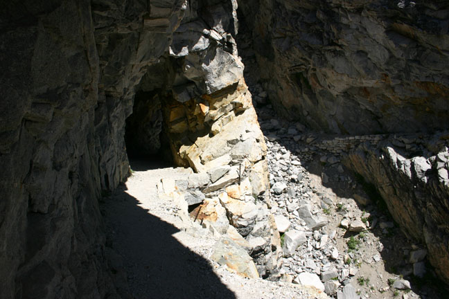
The march up to Prescipice Lake is one of my favorite parts of the trail. Each switchback shows you a slowly shrinking view of Hamilton Lake, a the first feeling of really being in the mountains hits you. A huge gorge reveals the remnants of an old suspension bridge, built in 1932, that was destroyed by an avalanche in 1937. Instead of replacing it, the talented Civilian Conservation Corps carved a shelf along the cliff edge, and somehow blasted a tunnel through the granite. Eventually we make it to the top of Kaweah Gap, and admire the view of Big Arroyo Canyon.

From here, there's nowhere to go but down. A few small lakes dot the rock strewn path, with small patches of green here and there. In the distance is what we assume to be our destination for the day, Big Arroyo Junction. The scenery on this side of the Gap is quite a contrast to the other side, with big open meadows interspersed with Sugar Pine forests. We're a bit tired at this point, and proceed in a one-foot-infront-of-the-other fashion. The day grows longer, but we're still not sure how much further it is to camp.

It turns out that Big Arroyo Junction is a lot further than we thought, and we arrive at camp quite late in the afternoon. Only one other person (Tim?) is there, and we become quick friends. Tim has lightweight backpacking down to an artform, and shows us his method of having all meals be perfectly square (not vitamin-wise, but geometrically) and weighing 1.5 pounds each. We gawk in amazement, and carefully put our plethora of ziploc baggies out of Tim's sight. We have a nice little fire and swap stories of life, the universe, and everything. We worry about where the Brits are, but not enough to keep us from falling asleep quickly.

Day 3, and we're greeted by the first wave of Brits as we're packing up camp. It seems they couldn't figure out how far the camp was either, and ended up sleeping on the trail a few miles back. Today's hike is relatively short (8 miles) and takes us to Moraine Lake, an amazing camp site in the trees beside an equally amazing lake. We have plenty of time here to relax, swim, and do laundry, as we arrive shortly after lunch. We realize that we could quite easily cover more miles in a day, but opt not to adjust our itinerary. We've come to like the company of the Brits, and Rebecca isn't meeting us until day 7 anyway, so arriving early wouldn't serve any purpose.

Spririts have been fairly low among the Brits, with one soldier sitting on his pack and refusing to go on. Today's easier hike has lifted their spirits somewhat, and they enjoy splasihing around in the lake and spending a relaxing afternoon, their heavy packs forgotten for the time being.

On day 4 we're up with the sun, pause to snap a photo of the mist-covered lake, and on the trail early. Tonight's camp site is Kern Hot Springs, and the idea of a hot bath is foremost on our minds. We pass through a beautiful open marshy area, then plunge into a Jeffrey Pine forest as we proceed along the canyon. Early in the afternoon we arrive at Kern Hot Springs, which is exactly as promised. A roughly made cement bath tub, with plugs to control the flow of hot spring water, proves irresistable. We quickly set up camp, then each take our turns with a long soak in the tub. We want to make the most of it before 3 dozen soldiers have their go. Later in the evening, I have another soak or two after the Brits have finished their turn. Ian hopes to share a bath with Lynn, one of the prettier co-ed officers, but unfortunately it happens only in his imagination. We also discover that one of the troops has managed to spill honey inside her backpack, earning her the endearing nickname of Honeypants.

The hot springs did wonders for our sore muscles, and the next morning we are excited to get on the trail and explore new territory. The Brits made an early start, which gave us the opportunity for another quick morning bath before hitting the trail. At this point we noticed, a bit too late, that the campsite actually had a rough outhouse - alas, alas.

We're now on day 5, and proceeding along the bottom of Kern Canyon. Even though there's no panoramic views from within the canyon, each corner brings new scenery and points of interest. The sides of the canyon range from 2000' to 5000', so we don't see the sun until close to lunch, when it quickly turns from cool to dry and hot. The Brits have arranged for a resupply via mule team at lunch time today, so we join in the excitement as they exchange huge loads of garbage for huge loads of food. We also take the opportunity to discreetly ask the Staff Seargant for some extra toilet paper. He politely shouts at the top of his lungs for someone to bring the Canadians some toilet paper. A couple of the young ladies comply, much to our embarrasment. They also invite us to load up on MREs (Meals Ready to Eat), where we grab a few treats to sample. I'm partial to the crackers and jam, and Ian is impressed by the single-use disposable camp stoves. Ah, military efficiency!

In the afternoon we begin the ascent out of the canyon towards Junction Meadow, where the High Sierra Trail intersects with the John Muir Trail (our goal for 2008). At Junction Meadow we meet Brian, a US Marine who is nearing the end of a 3 week hike of the John Muir Trail. This turns out to be quite a busy camp site, and we make lots of new friends. There is plenty of room, and everyone finds a place to call home for the night.

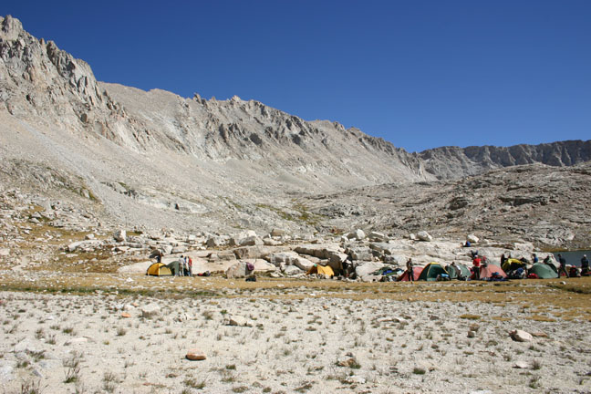
Day 6 has us heading to Guitar Lake, the last campsite before Mt Whitney. We're starting to realize that our goal is within sight, and we're still feeling great. Our packs are now lighter than ever, with only a couple days' food left, we're acclimatized, and healthy. Ian is a bit worried about an ankle injury he got a few days prior, but one of the British medics provided him with a neoprene support and it's proving to be effective. The day is uneventful as we slowly gain elevation, and in the early afternoon we arrive at Guitar Lake. After finding a sheltered spot to set up camp (it's very windy at Guitar Lake) we proceed to do some exploring. We hike around for a few hours, and then head back to the camp site to greet the arrival of the army. The flat area around Guitar Lake is a sensitive alpine meadow, so the small camping area becomes densly packed with tents. With the close proximity of our neighbours, and the excitement of tomorrow's summit, we stay up later than normal telling jokes and stories with the troops. Fires aren't allowed at this elevation, so we wear everything we brought and stand around shivering. Eventually we go to bed, and drift off to sleep with dreams of sumitting Mt Whitney in the morning.

It's summit day, and everyone is up extra-early for today's long hike. The trail quickly gains elevation, and switchbacks its way up the "back" side of Mt Whitney. After a few hours of hard work, we reach Trail Crest, where the spur trail to the summit turns off. Most hikers opt to leave their packs here and just take a snack and water up to the summit with them. There's no water to be had on the trail, so we have plenty with us. The packs are relatively safe to leave unattended as we're too high for bears, and the bear-cannister will deter any rodents. The trail becomes quite busy at this point, as we combine with day- and weekend-hikers from Whitney Portal. Everyone is exhausted but in high spirits as the summit gets closer and closer.

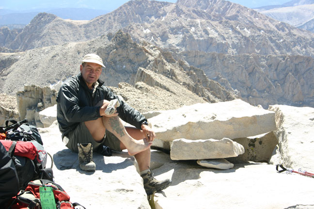
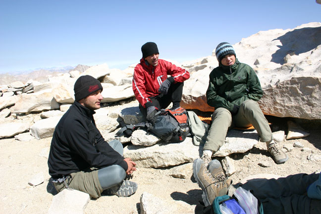
We made it! The highest point in the continental US, 14,495 feet! We celebrate with a few photos, and a couple of shots of overproof rum, courtesy of some friends we made at the summit. We spend about an hour exploring and recouperating, then pry ourselves away to begin the descent. 20 minutes into our descent, we run into the Brits on their way up. It didn't take much taunting for them to convince us to join them going back to the summit. We really wanted a picture of ourselves with them at the top, so off we went, two summits in one day!

After two dozen pictures from two dozen cameras, we depart for the second time and head back to pick up our packs from Trail Crest. The long march down takes us past 100 switchbacks, and we're glad we didn't begin our hike at this end. Many people attempt it and fail, and we pass people still trying to attempt it, who will most likely be hiking home in the dark.

That night, we make camp at Trail Camp, a busy camp site with amazing views of the summit. Later in the evening, the Brits pass us, but decide to head further down to Outpost Camp to enable a shorter trip the next day. We're disappointed that we don't get to spend our last evening with them, and hope to catch them the next morning before they get picked up.


The trip down to Whitney Portal was pleasant, and we past many hikers beginning their gruelling climb up. The downhill hike was very fast, and before we knew it we were at Whitney Portal Store, along with all the Brits. The biggest breakfasts we've ever seen are ordered, and we share a pancake the size of Rhode Island. Seriously, it was at least 3 feet across. I gained back the 10 pounds I lost on the trip in one meal. Shortly thereafter, the Brits get picked up and are whisked away to their next adventure.

Rebecca is meeting us at the nearby campground, so we go for a walk to see if she's there. It's still fairly early, so Rebecca hasn't arrived yet. We walk back up to the store where Brian, who is also getting picked up later in the day, teaches us some card games and swaps stories. We have a large lunch from the store, then begin to wonder why Rebecca isn't here yet. We invite Brian to join us on a walk to the campsite, where we eventually meet Rebecca, who cooks us all an amazing dinner. Brian gets ahold of his family and arranges for them to meet us at the camp site, so he can join us for the evening campfire. We're sad to be off the trail, but are still revelling in the accomplishment. We're now hooked on adventure, and know that we'll be coming back.